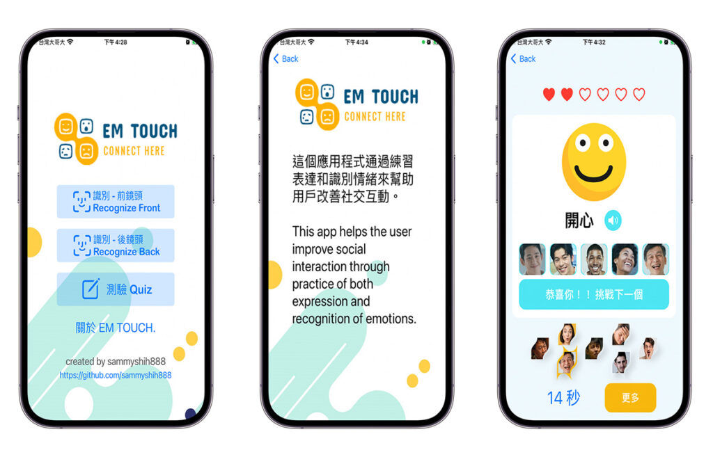
Role: App design
Duration: June – September 2023
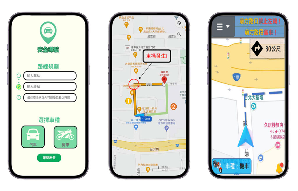
Map that takes in data of the frequency of accidents on certain roads or areas and gives routes to the user in order to avoid driving through these areas.
Introduction
Thousands of road traffic accidents occur every month, causing thousands of injuries and even dozens of deaths in Taipei City. Through the Road Safety Information Network, our team found that “driver’s negligence” is the main cause of accidents, accounting for 98.3% (24,708/25,141 cases), and the number is increasing year by year.
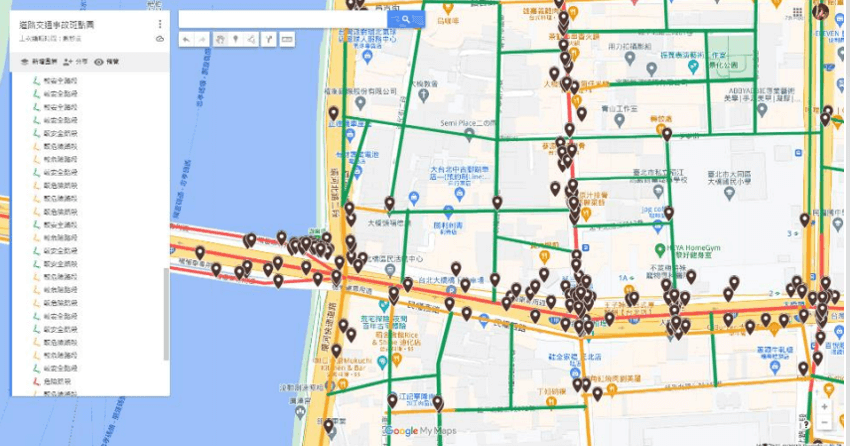
Through data from the Taipei City Real-time Traffic Network, our team found that the website lacks information on locations where accidents often occur. As a result, drivers may not notice dangerous intersections and locations where accidents often occur, and may not pay special attention to road safety.
Traffic signals are an indispensable element for the smooth operation and safety of a city, and their importance cannot be underestimated. However, some people may ignore the existence of traffic signals or even ignore their instructions, which may lead to traffic accidents.
Many websites use visual information as a reference for driving. For example, Google Maps will inform the user in red when there is a traffic jam and provide the user with other alternative roads. This is all visual information, which increases the risk of a car accident while driving.
We have put forward the “Car Safety Plan” to solve this increasingly serious problem. We will add cameras at dangerous and remote intersections to display information such as real-time road conditions and real-time weather data, so that we can respond to road conditions more quickly.
By combining the National Road Safety Information Inquiry Network, the data from the Road Safety Information Network can be displayed on the Taipei City real-time traffic network, and then an audio voice is used to remind users to pay attention to traffic accidents on the road section number and to be careful when passing this road section, thereby reducing the risk of traffic accidents.
We plan to properly plan and set up appropriate technological law enforcement equipment for hot spots and main causes of accidents. According to the characteristics of different road sections, corresponding ban items (improper turns) can be selected for specific violations, add technological law enforcement equipment, and strengthen traffic violation operations to achieve an optimal law enforcement effect.
System Functions
The vehicle safety alert system can display information such as real-time road conditions, vehicle accidents or traffic jams, real-time weather data, etc., so as to respond more quickly to road conditions and weather conditions that may pass by on the road.
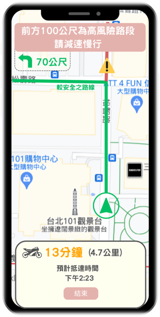
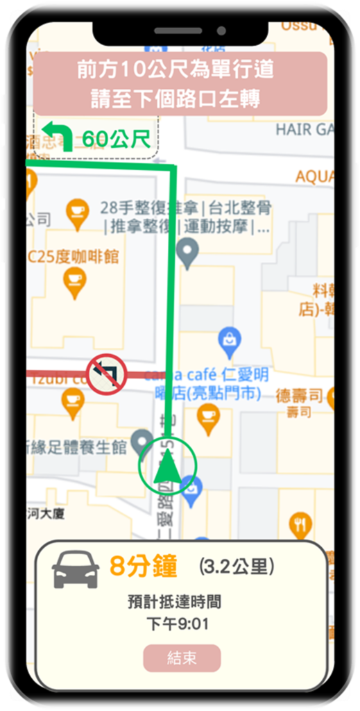
The system combines navigation with road risk prediction models and real-time weather data, and then displays information through voice playback to reduce driver distraction, so as to avoid high-risk road sections and reduce the danger of passing through abnormal weather areas.
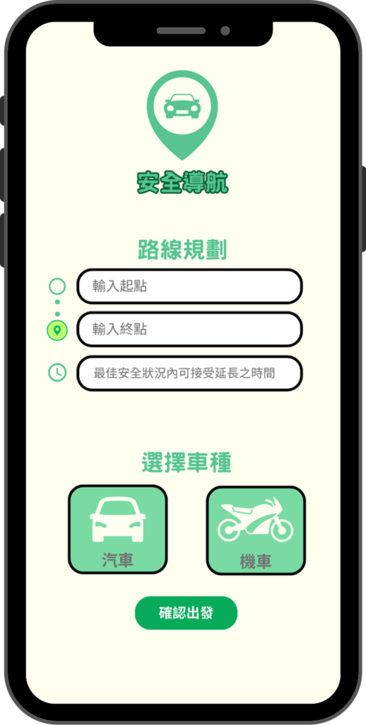
Safe navigation
- Combined with the safe navigation assistant provided by Google Maps API.
- Add navigation to road risk prediction models, real-time road conditions and weather to avoid dangerous road sections in advance to improve safety.
Real-time traffic alerts
- Combining various data on the road (such as the number of seconds of traffic lights or lighting methods), and organizing relevant information according to vehicle types.
- Drivers can instantly grasp the corresponding road conditions and sudden and abnormal weather conditions, effectively preventing accidents caused by neglect of paying attention to road conditions while driving.
Based on the Taipei City road traffic accident data set and the real-time traffic volume of each road section, the risk index is graded for each road and intersection.
The risk levels of each road section and intersection, real-time traffic flow, traffic light change patterns, and various information required to calculate the additional time required to walk on alternative roads are sent to the SVR regression analysis model for training, and a road risk prediction model is obtained.
Real-time traffic display
- Based on road section risk assessment and other data, the data on road conditions, road speed limits and road signs are combined, and the combined data is allocated to corresponding function selections according to the differences in car and motorcycle driving.
- The system uses voice prompts and reminders from side warnings to help drivers pay attention to road conditions and prevent distractions from causing mistakes.
Reference data set and website data
- Use the traffic accident statistics time and location in “Taipei City Road Traffic Accidents by Month”
- To achieve the end-to-end functional process within safe navigation
- Traffic accident risk-related features use the accident location, time, treatment category, etc. from “Taipei City Road Traffic Accident”
- Perform data preprocessing and finally integrate it into “traffic accident risk characteristics”
- Road section risk assessment and other data, combining data such as “road events”, “road speed” and “road signs”
- The navigation function uses “Taipei City Road Traffic Accident” and “Real-time Traffic Volume of Each Road Section”, and will use “Risk Level of Each Intersection”, “Real-time Traffic Volume” and “Calculate Walking Alternative Roads” as parameters of the risk prediction model